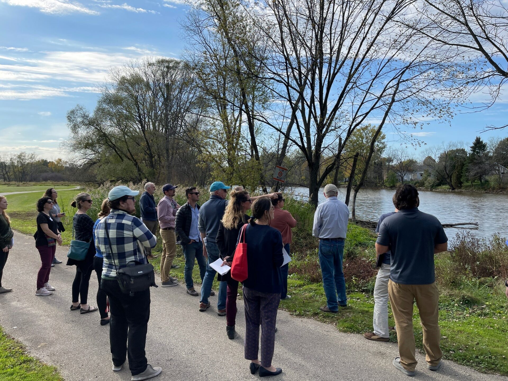
A group surveys a site along the East River in Green Bay that was hardest hit by flooding in 2019. Photo: Lamont Smith, The Nature Conservancy
Since 2020, the East River Collaborative has demonstrated that it takes a village—and coordination between municipalities, state and federal government, nonprofits and universities—to improve water quality and flood resilience at the watershed level.
“It’s very challenging for municipalities to work across boundaries with other municipalities,” said Julia Noordyk, water quality and coastal communities outreach specialist with Wisconsin Sea Grant. Noordyk works alongside partners at The Nature Conservancy and NEW Water (the brand of the Green Bay Metropolitan Sewerage District) on a core team that provides coordination and technical assistance to communities in the East River watershed.
“Every community is extremely different, and we’re not there to tell them what to do,” said Noordyk. Municipalities in the watershed span the rural-urban spectrum and vary in population, budget size and capacity.
“We’re there to listen and to figure out how to help them achieve flood resiliency based on what their community’s goals are.”
The 40-mile-long East River spans three counties in northeastern Wisconsin—Calumet, Manitowoc and Brown—and passes through agricultural, suburban and urban landscapes before it meets the Fox River and empties into the Bay of Green Bay. Historic flooding in March 2019 resulted in 50 houses being condemned and spurred the creation of the East River Collaborative the following year.
Since that time, the collaborative has worked with communities to identify shared goals across the watershed and developed maps and models to visualize flooding impacts. Now, with a new wave of grant funding, the collaborative is moving to the next phase: developing an implementation plan to identify and prioritize new projects.
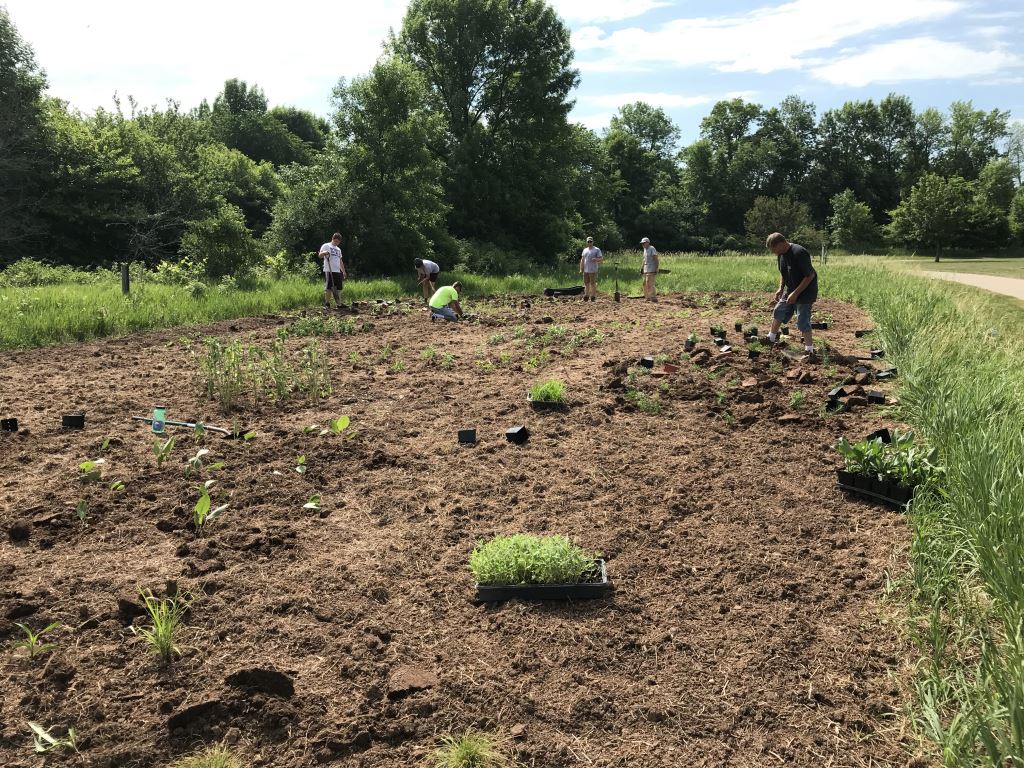
Volunteers replace turf grass with native plants along the East River in Ledgeview. Photo credit: Stephanie Schlag, town of Ledgeview
To help communities make these decisions, the East River Collaborative team is building a new tool to evaluate how well different nature-based solutions capture, slow and clean stormwater on the landscape. Nature-based solutions include practices like planting native plants, using rain barrels, building agricultural runoff storage systems and stabilizing streambanks.
Even though the tool is still in the planning stages, communities aren’t waiting to get local projects off the ground.
At the fourth annual East River Collaborative Winter Forum in February, partners gathered virtually to share their work restoring wetlands, removing invasive species, planting pollinator plants and designing canoe/kayak launches for the East River water trail—among many other projects.
“[The implementation plan] has really been a catalyst for other communities to think about this and start moving forward on resiliency themselves,” said Noordyk.
Another goal of the implementation phase is to build relationships with underserved residents who are likely to experience flooding and need the most support to recover from it due to factors like income, language and age.
A federal grant from NOAA Digital Coast will allow partners to connect with and learn from other municipalities that have worked with underserved communities on similar projects. The team is also pursuing funding for a survey that will gather residents’ feedback on strategies to prepare for and reduce flooding.
Adam Bechle, Wisconsin Sea Grant coastal engineering specialist and member of the East River Collaborative core team, is particularly excited to work with partners on establishing a flood warning system for the river.
“We worked with the Army Corps of Engineers and the National Weather Service and other partners to figure out what needs to happen so that the Weather Service can start putting together a forecast model,” said Bechle.
Both he and Noordyk said it’s been encouraging to see communities’ sustained interest in working together on these issues, even when flooding isn’t an imminent threat.
“We still have the same number of people showing up to meetings as when we kicked off,” said Bechle.
The East River Collaborative has been funded by the Wisconsin Coastal Management Program, National Oceanic and Atmospheric Administration, The Fund for Lake Michigan and National Fish and Wildlife Foundation. To learn more, visit the East River Collaborative’s website.