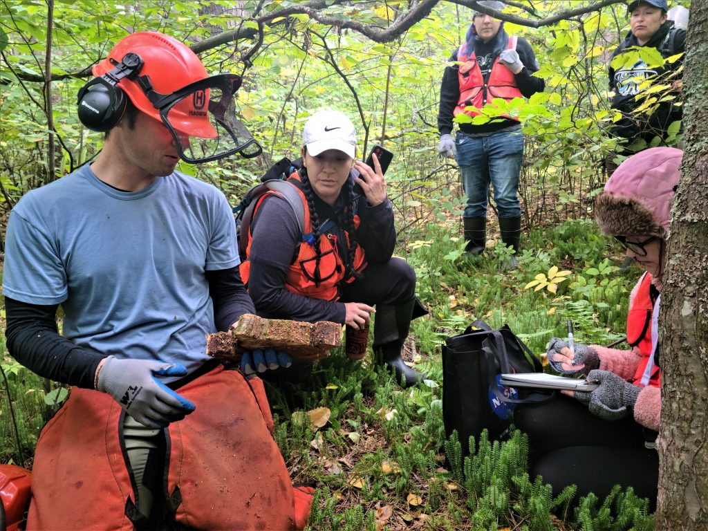
The research team at work on Wisconsin Point. From left to right: Evan Larson, Ashla Ojibway, Mocha Reynolds, Valerie Zhaawendaagozikwe and Emily Lockling. Image credit: Marie Zhuikov, Wisconsin Sea Grant
On a cool, sunny spring morning among the pines on Wisconsin Point along Lake Superior, a mix of Native and non-native people gathered in a circle with the scent of wood smoke and sage in the air. The small group was performing an opening ceremony for “Nimaawanji’idimin Giiwitaashkodeng.” This is the Anishinaabe name for a Wisconsin Sea Grant-funded research and outreach project designed to explore how the Anishinaabe people connected to and homesteaded the lands of “Zhaagawaamikong Neyaashi” (Wisconsin and Minnesota points) and how they used fire to manage the landscape. The project name translates into “We are all gathering around the fire.”
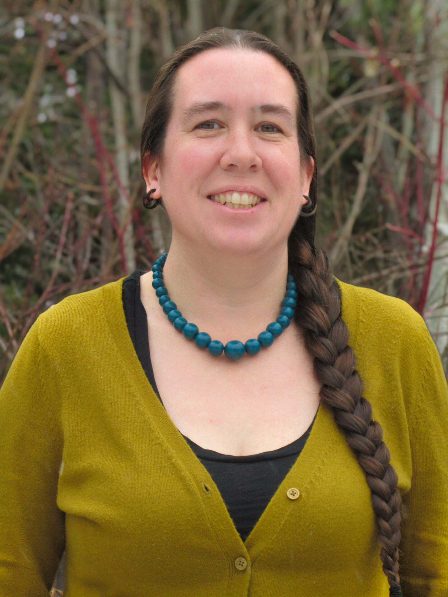
Melonee Montano. Submitted photo
The ceremony was held to “…let the animals and plants and the spirits there know what our intentions are as far as the research,” said Melonee Montano, a Red Cliff tribal member and a University of Minnesota graduate student who is one of the investigators leading the project. “We were asking for their permission and also for any guidance that they could give us moving forward so that we do things in the right way.”
As the ceremony continued, a deer emerged and stood at the tree line, looking at the group for at least 20 minutes. “She just hung out for a long time, checking us out, wondering what we were doing. For me, that was a real good sign that what we’re doing is OK,” Montano said.
Later, in June on the first day of summer, a larger ceremony was led by Ricky DeFoe, Fond du Lac Elder and spiritual leader. The ceremony brought over 30 members of stakeholder groups together to publicly open the project. It included representatives from the cities of Superior and Duluth, the Great Lakes Indian Fish and Wildlife Commission, University of Wisconsin-Madison Extension, the Douglas County Board, Sea Grant and the Fond du Lac Band of Lake Superior Chippewa. As the group stood around a sacred fire, DeFoe talked about the need to reconcile history and come together to heal people and the land.
Wisconsin and Minnesota points were home to the Anishinaabe people for hundreds of years before the forces of settler-colonialism began threatening their relationship to the area. Treaties and federal legislation drew explicit lines around reservations and industrial interests began to covet Zhaagawaamikong Neyaashi.
As the Anishinaabe presence diminished, their influence on the land weakened as well, including a decline in their use of “Ishkode” (fire). Settlers suppressed Ishkode and the landscape changed, losing biodiversity and resilience.
Research project reaches into the past
Managed by Evan Larson, professor of geography and a dendrochronologist with the University of Wisconsin-Platteville, the Nimaawanji’idimin Giiwitaashkodeng Project seeks to combine tree-ring data with Indigenous Experiential Knowledge: the deep understanding that Indigenous people have developed through millennia of close observation of and engagement with the ecological webs of the Great Lakes Region. This understanding, sometimes also referred to as Traditional Ecological Knowledge, puts data derived from tree rings into context in terms of Ishkode as an ecological and cultural process. The ultimate goal is to restore the cultural use of Ishkode to increase the resilience of the ecosystem and to maintain “miinan” (blueberries), a key traditional food source among the Anishinaabe.
Miinan are one of the important first foods for the Anishinaabe, along with strawberries, wild rice, maple syrup, deer, rabbits and others, Montano said. “We’ve moved away from blueberries and the other first foods these days for multiple reasons like government commodities and smaller land bases, but we’ve also lost some of the connections or knowledge on how to gather them.”
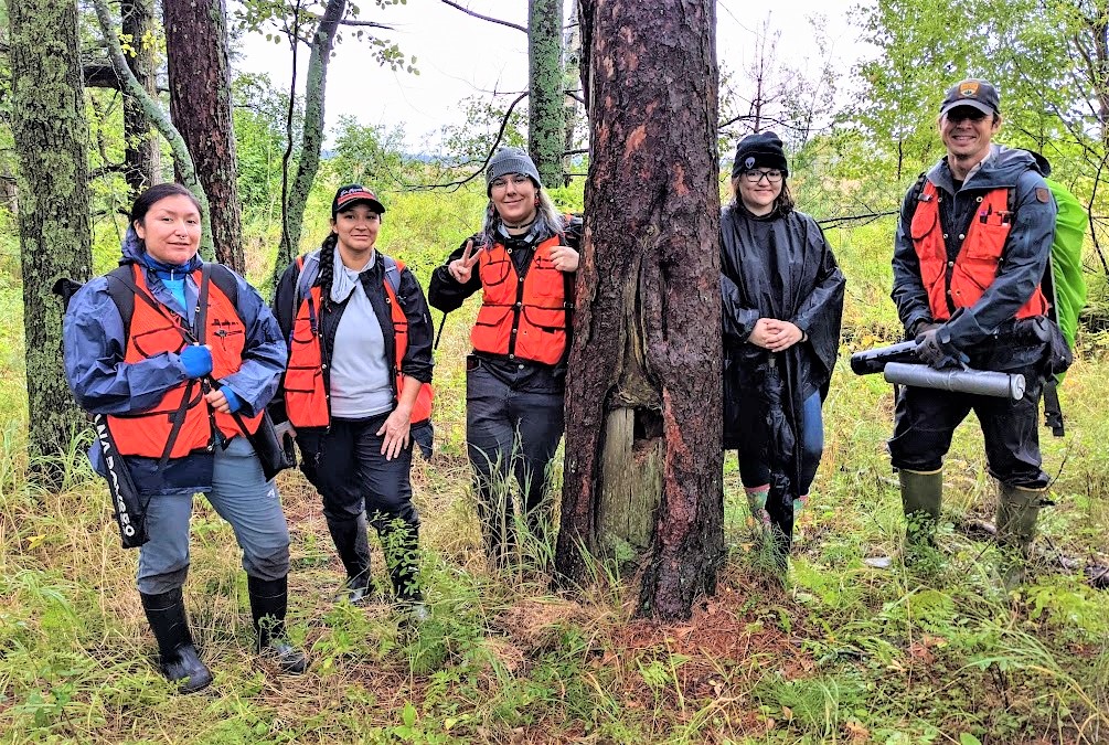
The project research team on Wisconsin Point. From left to right: Valerie Zhaawendaagozikwe, Ashla Ojibway, Mocha Reynolds, Emily Lockling and Evan Larson. They are standing next to a culturally modified pine that shows signs of tool marks from over 100 years ago. Image credit: Lane Johnson
In October, Larson and a team of four undergraduate students from Fond du Lac Tribal and Community College and the University of Minnesota Duluth visited Wisconsin Point to search for downed and dead trees to sample for the project. They were seeking signs of past Ishkode or tool marks etched into the rings of trees that could be used to learn more about the history of the place.
They gathered at the Lake Superior Estuarium in Superior, which housed slices of wood they had collected on two previous outings. Mocha Reynolds, an environmental science major, pointed to places on the samples where the tree rings had been interrupted.
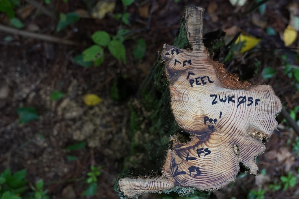
A slice from a tree with marks showing where it was first peeled by people and then scarred by two passing fires. Image credit: Evan Larson
“This one, you can see where people have peeled the bark away,” Reynolds said. “The tree healed then and grew around it. From these blackened spots, you can also see that a couple of fires have touched this tree in its life. We feel like there’s a pretty good chance that they were prescribed burns by the Anishinaabe.”
The samples will soon be sanded and polished to make it easier to see individual growth rings and any interrupting patterns that tell of past fires or peel scars.
Of food, medicine and resin
Larson explained that people might have peeled the bark off the tree for a variety of reasons. Sustenance is one. During starvation periods, the starchy inner bark of trees can be used for food. Different parts of the inner bark might also be incorporated into medicines.
Larson said that the provisions provided by trees on the points were likely linked to the daily lives of the Anishinaabe, particularly how they traveled to the area in birchbark canoes. “The Latin name of red pine trees is Pinus resinosa, and the reference to resin is apt. A tree that has had its bark peeled from part of the trunk will respond by infusing the wound with resin, often referred to as ‘sap.’ If you’ve ever climbed a pine tree and found your hands covered in the sticky stuff, you know what I’m talking about,” Larson said.
The resin protects the injured tree from decay, much like blood forms a clot when a person’s skin is pierced. The resin pools along the edges of the peel and can then be collected and combined with other materials to make the gum used to build and repair birchbark canoes.
Each sample that Larson and the students collected was labelled in Anishinaabemowin: Zhaagawaamikong-neyaashi for those collected on Wisconsin Point and “Onigamiinsing” for those on Minnesota Point. They were also mapped. Using the techniques of dendrochronology (tree-ring science), the team will be able to determine exact calendar years of each Ishkode and peel scar from the samples.
“That information then can be used to understand where the fires were. Did it burn the whole point, or did you have a small fire over here one year, and a small fire over there another year?” Larson said. “That will give us a sense of the spatial aspects of how fire and people interacted with the landscape.”
Larson compared the process the research team uses to find collectable trees to instructions he saw once on a chocolate truffle package. “It said to truly experience the truffle, first you look at it, then you smell it. In a way, these are the same because of that resin that Mocha was talking about. It’s just infused throughout the wood. So, these stumps, they’re from trees that have been dead for 100 years or more in some cases. Their appearance gives you the first hint of what’s inside. And on that first draw of the saw, the wood chips fly and all of a sudden you just like, (sniff), you can just smell the resin. And that’s … yeah,” Larson said.
“It’s a really good smell,” Reynolds echoed.
Red pine and white pine reproduction
The team then drove to the end of Wisconsin Point, where a lighthouse and shipping canal are located. After making a tobacco offering to Lake Superior, Larson and crew traipsed inland into a red pine forest. During the hike, Larson offered his perspective on the current landscape.
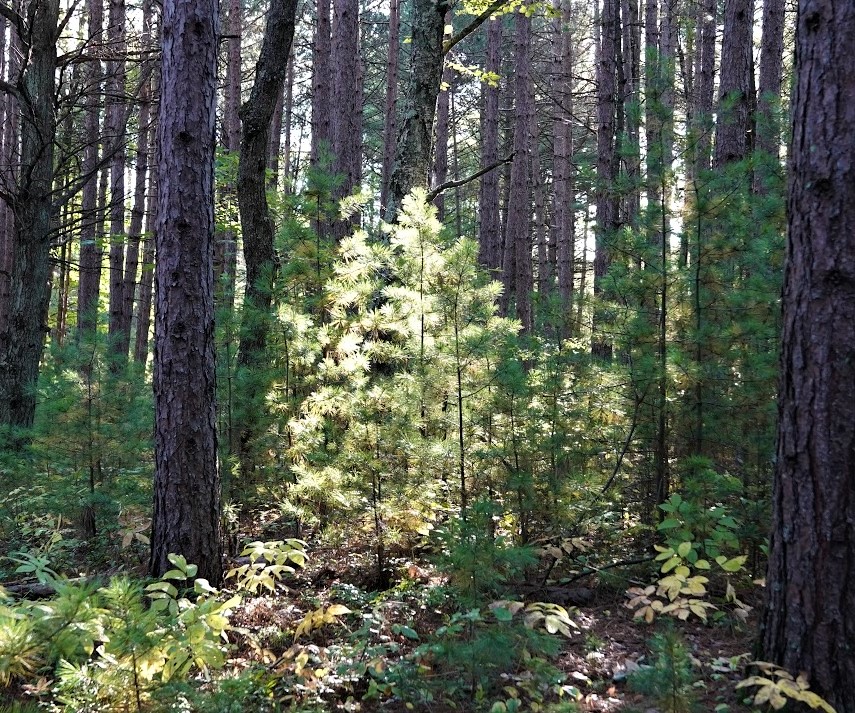
White pines regenerating in a stand of red pines on Wisconsin Point. Image credit: Evan Larson.
“In some places, you can still see the legacy of fire here, like blueberries and red pine. But if you look at the lower layer now, there’s no red pine and a lot of hazel. All of the new pines coming up are white pine, which is more shade-tolerant than red pine. White pine seeds can get through a little bit of duff. Red pine seeds, when they fall on all this duff, just land on the needles and litter. They can’t get to the mineral soil to germinate. So, all these red pines will cast seeds for the rest of their lives, but they will very likely never result in a baby pine tree until there’s a fire.”
The students had already mapped some stumps and downed trees to investigate. When they rediscovered one, Reynolds did something surprising. She kicked it. She explained this is done to make sure the stump or snag is solid. That indicates the tree had scarring during its life and has produced resin to heal. The resin makes the tree sturdier. So far, so good.
Larson pointed out a triangular wound that began on the trunk and extended wider to the base at ground level. “That generally is the healing mode of a tree that’s been damaged by fire,” Larson said.
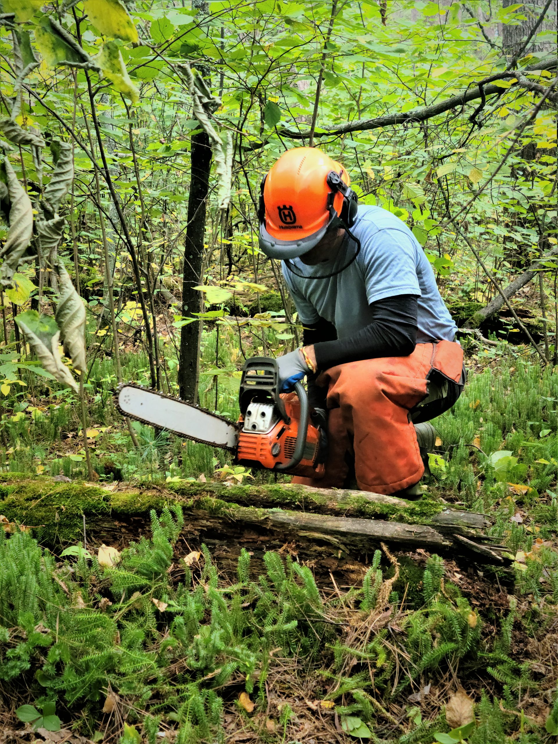
Evan Larson saws through a dead and downed fire-scarred tree on Wisconsin Point. Image credit: Marie Zhuikov, Wisconsin Sea Grant
He chainsawed though the tree and extracted an inch-thick sample. Valerie Zhaawendaagozikwe, an environmental science major, noted an Ishkode scar. Larson pointed out three more, possibly from a peel and other fires.
Anishinaabe Chief Osaugie was one person connected to Wisconsin Point in the past. He was a renowned canoe-builder and must have gathered resin to make the gum for the canoes. “To see a peel scar on this stump – to suddenly realize that, I mean, we don’t know who made that peel, but it could’ve been him. We are holding history in our hands, covered in moss. That’s pretty cool stuff,” Larson said.
Emily Lockling, a geographical information science student, carefully mapped the sample’s location.
As they searched for another sample, Zhaawendaagozikwe explained what drew her to participate in the project.
“I grew up on the West Coast, so I grew up seeing culturally modified trees, like the cedar trees. People still peel them for hats, baskets, clothing and things. I got to so I could tell when a tree had been peeled by a Native. When I came here, I got an email about this project. I thought I would enjoy this work because I already had an idea of what it is. I also enjoy being outside,” she said.
The team crossed a road on the point, moving closer to the lake. As Ashla Ojibway, another environmental science major, demonstrated how they use a hand saw to get samples from stumps, a bald eagle called above her. Remember the deer from the beginning of the story? The eagle, it seemed, approved of the project as well.
The importance of capturing stories
Just as the landscape chronicles the past, stories held by people are also important for understanding this place more completely. As snow begins to cover the land, Montano will be working with Elders and community members to gather memories and stories of Zhaagawaamikong Neyaashi, Ishkode and miinan.
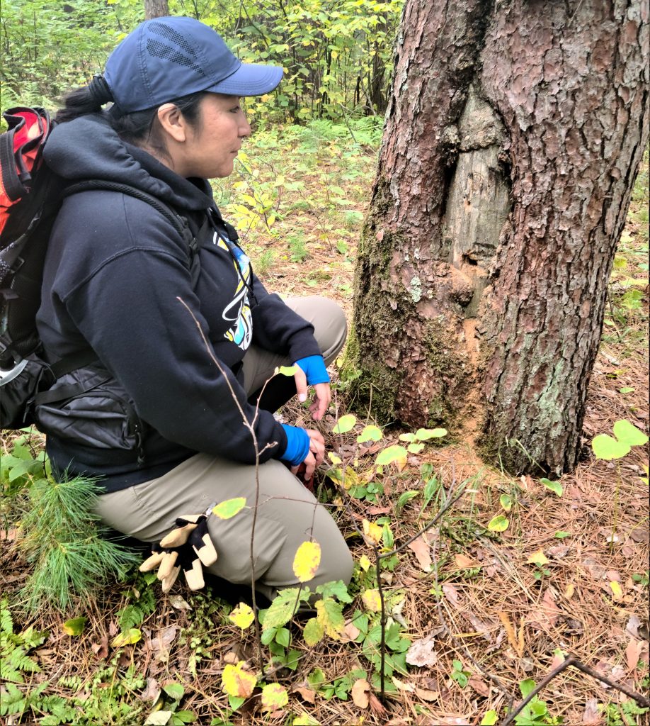
Valerie Zhaawendaagozikwe inspects a red pine that shows signs of cultural modification and fire. Image credit: Marie Zhuikov, Wisconsin Sea Grant
“Together, the memories of people and trees will help us understand the deep connections that weave the community of life found on the points now and in the past. They’ll help guide us moving forward,” Larson said.
To ensure that information from the project reaches a broad audience and engages in societal change, Montano and Larson are creating an illustrated children’s book with the help of Robin Wall Kimmerer, noted author of “Braiding Sweetgrass,” and distinguished professor and director of the Center for Native Peoples and the Environment at the State University of New York. The book will be published by Black Bears and Blueberries Publishing, a Native-owned company, and will be distributed to teachers and students through another Sea Grant-supported project, Rivers2Lake.
Montano is applying her interviews with Elders to the children’s book but also to her graduate research about the relationships between Ishkode and people. She described the topic of her interviews as, “Basically looking at who fire is as a being rather than what fire is.” The Anishinaabe believe that Ishkode has a spirit, similar to their beliefs about animals and other aspects of nature.
To reach scientific audiences, Larson and his students will present their results at the American Association of Geographers Annual Meeting in spring 2023. Montano, Larson and students will also be giving a public-friendly presentation for the River Talk series on Jan. 11, 2023.
Back on the field trip, the team wasn’t as lucky with the last sample they collected. Although the stump passed the “kick test,” the inside heartwood was completely decayed and there weren’t enough intact rings.
Larson said, “From a tree-ring perspective, we don’t have enough material to work with this sample. We know it was a peel. We know it holds that information. But for this study, that’s as far as we can go, which also shows the urgency of doing this work now because these injuries and these scars on these trees are from a time hundreds of years ago. They’re an expression of people and their connection to place.
“Through a huge range of reasons — legislation, boarding schools, treaties, the systemic racism that has engendered a systematic approach to what boiled down to genocide in a lot of ways, has taken this relationship and put it on pause. So, these trees have been living on this land, carrying this story and these relationships in their rings for all this time, but trees die, too. These trees are now old. That story is long enough ago that these trees are the last vestiges of that tangible legacy. That’s why we’re doing the work now so that we can capture that story now before it turns into dust.”
Other partners in the project include representatives from the Minnesota Department of Natural Resources, the Lake Superior National Estuarine Research Reserve, the Lake States Fire Science Consortium, the University of Minnesota Cloquet Forestry Center, and St. Anthony Falls Communications Manager Clare Boerigter, retired Wisconsin State Archaeologist John Broihahn and Duluth-based visual artist Moira Villiard.


