
The formation of the Great Lakes
Thousands of years ago, the melting mile-thick glaciers of the Wisconsin Ice Age left the North American continent a magnificent gift: five fantastic freshwater seas collectively known today as the Great Lakes — Lake Superior, Lake Huron, Lake Michigan, Lake Erie and Lake Ontario.
How they were made
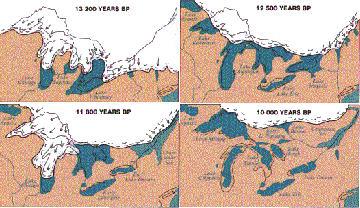
Thousands of years ago, the melting mile-thick glaciers of the Wisconsin Ice Age left the North American continent a magnificent gift: five fantastic freshwater seas collectively known today as the Great Lakes — Lake Superior, Lake Huron, Lake Michigan, Lake Erie and Lake Ontario. From the westernmost tip of Lake Superior at Duluth, Minn., to the easternmost tip of Lake Ontario at Watertown, N.Y., lakes stretch a thousand miles across the heartland of both the U.S. and Canada, creating nearly 9,500 miles of ocean-like shores.
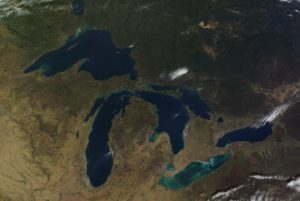
The lakes also contain an estimated 35,000 islands. Officially dubbed “the nation’s fourth seacoast,” the U.S. Great Lakes shoreline alone totals more than 4,500 miles — longer than the U.S. East and Gulf coasts combined. As seen from space, the Great Lakes constitute one of the most identifiable features of the North American continent as well as Earth. The North American Great Lakes are unique among the world’s large lakes in that their basins are linked together and form one continuous drainage basin. Together, they constitute the greatest freshwater system on Earth, covering an area larger than Texas and about half the size of Alaska. Starting in Lake Superior, the water flows out the lake’s southeastern tip down the St. Marys River into Lakes Michigan and Huron, which actually are two halves of one lake. From there, the water flows southward from the southern tip of Lake Huron down the St. Clair River through “little” Lake St. Clair and the Detroit River to Lake Erie. Leaving Lake Erie, it flows north via the Niagara River and over Niagara Falls into Lake Ontario. It then flows northeast down the St. Lawrence River — the last link in a 2,000-mile-long waterway that ultimately connects Minnesota to the Atlantic Ocean.
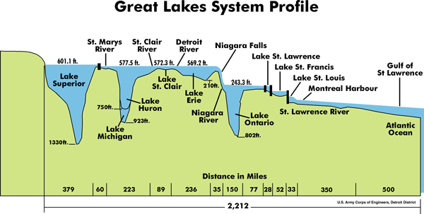
However, this stair-step arrangement of basins is relatively new and resulted from the slow rise of the land as it rebounded from the depressing weight of the mile-thick ice sheets. Lake Erie and southern Lake Michigan (Lake Chicago) were first unveiled by glaciers about 10,000 years ago. Both originally drained to the southwest, out the Maumee-Wabash-Ohio and Des Plaines-Illinois rivers, respectively, to the Mississippi River.
About 9,000 years ago, the early stage of Lake Superior, called Lake Duluth, drained southwest out the St. Croix and Mississippi rivers, along what is today the Minnesota-Wisconsin border. About 7,000 years ago, as the last ice left, the land to the southwest of Lakes Erie and Michigan had risen high enough that the lakes no longer drained in that direction. Lake Ontario came into being, and the Niagara River became Lake Erie’s outlet.
As the ice sheet retreated into Canada, it temporarily made Lakes Superior, Michigan and Huron into one huge body of water called Lake Nipissing, which had the unusual quality of having three outlets — via the Ottawa-St. Lawrence rivers, Detroit-St. Clair rivers and Illinois-Mississippi rivers. Lake Huron continued to drain eastward out the Ottawa-St. Lawrence rivers until about 5,000-6,000 years ago. Lake Michigan continued to drain out the Illinois River where Chicago now stands until about only 3,000 years ago, when the Great Lakes finally assumed their present shapes. The Great Lakes today hold an estimated 6 quadrillion gallons of water — a fifth, or 20%, of all the drinkable water on the surface of Earth. If all the water in the Great Lakes were spread evenly over the continental U.S., the 48 states would be flooded under more than nine feet of water. The surfaces of the lakes total more than 94,000 square miles — covering an area about the size of the entire state of Oregon.
The awesome sizes of the Great Lakes amaze just about everyone seeing them for the first time. These lakes not only look like oceans, they often seem to behave like oceans. They have coastal currents — including dangerous rip currents — and occasional large tide-like changes in coastal water levels called seiches (pronounced “say-shez”) caused by prolonged strong winds and passing storms, as well as storm surges and edge waves. Like the oceans, the lakes also moderate the temperature of the air and increase the amount of rain or snow that falls on the lands surrounding them.
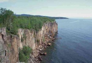
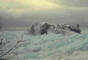
Some of the world’s largest grain shipping ports are located on the Great Lakes, and oceangoing ships as well as 1,000-foot lake vessels ply their waters. Sailors who have weathered storms on the Great Lakes give these inland seas the same healthy respect they give the other Seven Seas — perhaps an extra measure of respect when the icy “Gales of November” blow early, because the freshwater of the lakes freezes more quickly than ocean saltwater, and a heavy coat of ice can easily capsize and sink a ship. The lakes’ water is usually cold to begin with, because the Great Lakes lie across the 45th Parallel — halfway to the North Pole from the Equator and just 1,200 miles from the Arctic Circle, less than the distance between New York City and Miami.
Coupled with the vast forest, agricultural and mineral resources of the area, the abundant supply of water and cheap transportation afforded by the Great Lakes were major factors in the region becoming the population and industrial core of both the U.S. and Canada. About 50 million U.S. and Canadian citizens live and work in the Great Lakes region today, and around half of them depend directly on the lakes for drinking water. The United States’ third largest city, Chicago, is located on the shores of Lake Michigan, and the Great Lakes coastal cities of Milwaukee, Detroit, Cleveland and Buffalo, N.Y., have populations of more than a million people each. Ontario, the only Canadian province bordering the lakes, contains a third of Canada’s population, while nearly 15 percent of the U.S. population lives in the region. Five of the 10 largest U.S. states by population are Great Lakes states (#4-New York, #5-Pennsylvania, #6-Illinois, #7-Ohio and #10-Michigan).
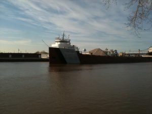
The iron ranges around Lake Superior have been the principal source of ore for North America for more than a century, and the economy of shipping large quantities of ore on the Great Lakes — plus the abundant supply of high quality water for processing it — have made the region a center of iron and steel production. Until recently, the shores and hinterlands of Lakes Ontario, Erie and Michigan held the world’s largest concentration of iron and steel mills. Even today, about half of the steel made in the U.S. and and nearly two-thirds of Canada’s steel is produced in the Great Lakes region. The region’s other major industries include automobile manufacturing, heavy machinery, paper mills, metalworking and shipbuilding. In addition, some 163 million tons of grain, iron ore and other commodities are shipped across the Great Lakes each year, and the sport and commercial fisheries of the Great Lakes currently contribute more than a billion dollars a year to the region’s economy. Along with the Upper Midwest’s multitude of lakes and forests, the Great Lakes help support a substantial regional tourism industry.
In fact, a 2020 analysis by the University of Michigan concludes that the Great Lakes generates $82 billion in wages each year and that more than 1.3 million jobs are directly connected to the waterways. Together, the U.S. and Canada share responsibility for protecting and caring for one of the most valuable natural treasures in the world — five magnificent gifts of the glaciers.
Lake Superior
The greatest of the Great Lakes is Lake Superior, the northernmost and westernmost Great Lake — and the biggest, the deepest, the coldest and the most pristine. Its name comes from early French explorers who labeled it “le lac superieur,” meaning “the uppermost lake.” According to Native American Objibway lore, it is protected by Nanabijou, Spirit of the Deep Sea Water.
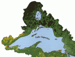
Roughly the same shape and slightly larger than South Carolina, Lake Superior has a surface area of more than 31,000 square miles — the largest of any freshwater lake in the world. Only Siberia’s Lake Baykal, because it is deeper, holds more water. Bordered on the north by Ontario, on the west by Minnesota and on the south by Wisconsin and Michigan, Superior at its greatest measures 350 miles long and 160 miles across.
The lake’s surface is about 600 feet above sea level, with an average depth of 490 feet and a maximum depth of 1,333 feet. Its clear, frigid waters are bordered by 2,980 miles of shoreline, 90 percent of which is forested, much of it still wilderness.
Superior’s flushing time — the time it takes for all the water now in the lake to be replaced by new water — is 191 years, the longest of any of the Great Lakes. This also makes Superior the most vulnerable to long-term water pollution: if the lake were to become polluted today, and all pollution stopped tomorrow, it would take almost 200 years before its water would again be as pure as it was yesterday.
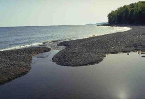
At Superior’s southeastern corner, its sparkling waters flow into the St. Marys River, a crooked 61-mile channel of water separating Michigan’s Upper Peninsula from Ontario. Just 16 miles from the mouth of the river and Lake Huron are the St. Marys Rapids, where the river drops about 20 feet in half a mile. For centuries, these rapids were a barrier to water travel between Lake Superior and the other lakes. It wasn’t until 1855 that the first locks and canal for moving ships around these rapids was built at the international twin cities of Sault Ste. Marie located in Ontario and Michigan.
Today there are five locks — four operated by the U.S. and one by Canada — including the giant Poe Lock, the largest on the Great Lakes, which can hold ships up to 1,100 feet long and 105 feet wide. In peak years, more tons of cargo passes through these locks than any other on Earth.
The greatest of the Great Lakes is Lake Superior, the northernmost and westernmost Great Lake — and the biggest, the deepest, the coldest and the most pristine.
Lake Huron
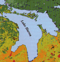
The second-largest Great Lake, Lake Huron, has a surface area of 23,000 square miles — slightly smaller than West Virginia — making it the fifth-largest freshwater lake in the world. Its name comes from early French explorers, who dubbed it “Lac des Hurons” (Lake of the Huron Indians). Bordered by the province of Ontario and the state of Michigan, Lake Huron measures about 206 miles long and 183 miles wide and has nearly 3,200 miles of shoreline.
At 579 feet above sea level, it averages 195 feet deep with a maximum depth of 750 feet and has a flushing time of about 22 years. About two-thirds of the lake’s 51,700-square-mile watershed is still covered by forests, and the lake contains more than 30,000 islands.
Lake Huron mainly functions as a conveyer within the Great Lakes system, carrying both water and ships from the other two upper lakes to the urban and industrial centers along the lower two lakes. The region is a major U.S. forest industry area, and some of the world’s largest nickel reserves are located in Ontario just north of the lake.

Along the northeast side of Lake Huron is Georgian Bay, created by the limestone spines of the Bruce Peninsula and Manitoulin Island. Though called a bay, it is so large that it has been nicknamed “the Sixth Great Lake.” The bay’s waters are nearly as unspoiled as those of Lake Superior, and its shoreline rivals Superior’s in rugged beauty.
At the northwest corner of Lake Huron are the Straits of Mackinac, a deep trench of water that joins Lake Huron with Lake Michigan. Because this deep channel equalizes the water levels of these two Great Lakes, Michigan and Huron are essentially two parts of the same lake. Spanning these straits to connect Michigan’s lower and upper peninsulas is the 5-mile-long Mackinac Bridge – the third longest suspension bridge in the world.
At its southernmost tip, Lake Huron empties into the St. Clair River. The water then flows through shallow, heart-shaped Lake St. Clair, out the Detroit River and into Lake Erie. The smallest lake in the Great Lakes system, Lake St. Clair has a surface area of 430 square miles but an average natural depth of just 10 feet. A 27-foot-deep navigation channel through the lake must be dredged periodically to ensure bottom clearance for large ships. The Lake Huron-to-Lake Erie waterway is more than 90 miles long, yet the difference in the elevations of the two lakes is only about nine feet. A sprawling industrial complex lines this waterway, including Port Huron and Detroit on the U.S. side and Sarnia and Windsor, Ont., in Canada.
Lake Michigan
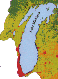
Lake Michigan is the third largest Great Lake and the fifth largest lake in the world. Bordered by Wisconsin, Illinois, Indiana and Michigan, it is the only Great Lake that lies entirely within the boundaries of the U.S. Its name comes from the Algonkian Indian word for it, “Michigami” (or “Misschiganin”), meaning “large body of water.”
Like Lake Huron, Lake Michigan’s surface is about 579 feet above sea level. It is slightly smaller than its twin, with a surface area of 22,300 square miles — about half the size of Tennessee. Lake Michigan averages 279 feet deep and reaches 923 feet at its deepest.
This long, narrow lake — 307 miles by 118 miles — is a natural cul-de-sac. Only a relatively small amount of water flows out the bottleneck at the straits between Michigan and Huron, so Michigan holds its water a long time — nearly 100 years.
Coupled with the large numbers of industries and people living along its 1,659 miles of shoreline — particularly in the heavily urbanized Milwaukee-Chicago-Gary, Ind., crescent along its southwestern shore — Lake Michigan’s long flushing time is why pollution of the lake is a special concern.
Lake Michigan has the largest sport fishery on the Great Lakes, valued at more than $250 million annually. Besides its world-class trout and salmon fisheries, the lake also supports substantial commercial whitefish and yellow perch fisheries.

The largest lakeshore dunes in the world are also found along Lake Michigan, attracting millions of people annually to the lake’s numerous beaches, coastal state parks and national lakeshores.
As in the days of the glaciers, some of the lake’s water today empties into the Mississippi River via the Chicago Sanitary & Ship Canal and Illinois River. While this canal has facilitated shipping and helped reduce pollution of the lake, in recent years it has also helped aquatic invasive species into the Great Lakes basin.
Lake Erie
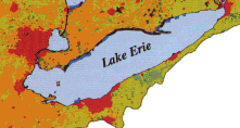
Lake Erie is the fourth-largest Great Lake and the world’s twelfth largest freshwater lake. Erie is about 210 miles long, 57 miles wide and about 570 feet above sea level.
Bordered by Michigan, Ohio, Pennsylvania, New York and Ontario, Lake Erie has 856 miles of shoreline, giving it a surface area of just over 9,900 square miles — slightly larger than the state of Vermont. Its name comes from the Erie (“People of the Panther”) nation of American Indians who once inhabited its southern shores.
Though the lake bottoms out at 210 feet, it averages only 62 feet deep. Because of its saucer-like shallowness, Lake Erie has a reputation among sailors of being quick to “kick up her heels,” raising waves of frightening size in even a modest gale.
Erie may well be the most used, most enjoyed and perhaps even the most loved lake of the five. Erie forms part of the top of the U.S. “industrial crescent” — the majority of U.S. and Canadian cars are made in this region, and it is a principal steel-producing area.
It also supports the second-largest sport fishery on the Great Lakes today (Lake Michigan’s is first), and its walleye fishery is generally considered to be one of the best in the world.
Erie’s water quality problems were legend during the environmental movement of the late 1960s, when this “dead” Great Lake became a national symbol of the effects of pollution and neglect. Fortunately, Lake Erie’s flushing time is less than three years — the shortest of all the Great Lakes — and the lake has been the quickest to respond to U.S. and Canadian efforts to improve waste treatment and reduce pollution of the lakes.
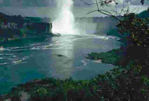
At Erie’s eastern tip, near Buffalo, N.Y., its water flows north into the Niagara River, racing downstream at 750,000 gallons per second. In a 35-mile stretch between Lake Erie and Lake Ontario, the river elevation drops 326 feet, nearly 200 feet of it all at once — at Niagara Falls, one of North America’s most famous geographic features and one of the natural wonders of the world.
A few miles west of Niagara Falls lies the Welland Canal, some say one of the most impressive man-made structures in the Great Lakes region. Operated by Canada, the 26-mile-long canal contains eight locks that lower and lift cargo ships around the falls.
After the falls, the rampaging river again swings east and empties into Lake Ontario, the last of the five Great Lakes.
Lake Ontario
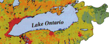
The opposite of Lake Superior in almost every way, Lake Ontario is the easternmost, lowest in elevation, smallest in surface area and perhaps the most polluted Great Lake. As the last lake in the chain, Ontario receives the accumulation of contaminants from the other Great Lakes in addition to the agricultural runoff, and urban and industrial waste discharges within its own basin. Its name originated with the local Iroquois Indians’ word for “a beautiful lake” — which it still is.
With a maximum depth of 802 feet, Ontario is the third deepest Great Lake after Lakes Superior and Michigan. It averages 283 feet deep at 245 feet above sea level and has a flushing time of about six years. The lake is 193 miles long, 53 miles wide and has 726 miles of shoreline, giving it a total surface area of about 7,300 square miles — nearly the size of New Jersey.
Lake Ontario is bordered on the south by New York and by the province of Ontario on the north. Canada’s commercial, industrial and population heartland is centered here, mostly around Toronto on the lake’s northwestern shores. About two-thirds of Canada’s steel is produced here.
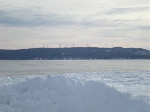
At the northeastern tip of the lake, its waters empty into the St. Lawrence River for a 1,200-mile journey to the Atlantic Ocean. Sliding around the beautiful Thousand Islands, the St. Lawrence moves northeast toward Montreal. This part of the river contains seven locks that were the keys to unlocking the Great Lakes to the world by creating the famous St. Lawrence Seaway. Opened in 1959, these Seaway locks lift and lower ships a total of 225 feet and give oceangoing ships easy access to the Great Lakes and their ports.
Just east of Massena, N.Y., the St. Lawrence River leaves the U.S. border and becomes solely a Canadian River. At Trois Rivieres — only half-way between Montreal and Quebec City and still hundreds of miles from the sea — the powerful influence of the Atlantic Ocean is first felt as the water level of the river begins to change with the ocean tides.
Finally, 2,342 miles from Duluth — where the St. Lawrence River is miles across — the waters of the Great Lakes reach the Atlantic Ocean. In total, the volume of water draining from the Great Lakes-St. Lawrence basins is so great that enough water flows out of the mouth of the St. Lawrence every 10 minutes to supply all people and industries of New York City for a entire day.